Creator
Dietrich, E.C.
Description
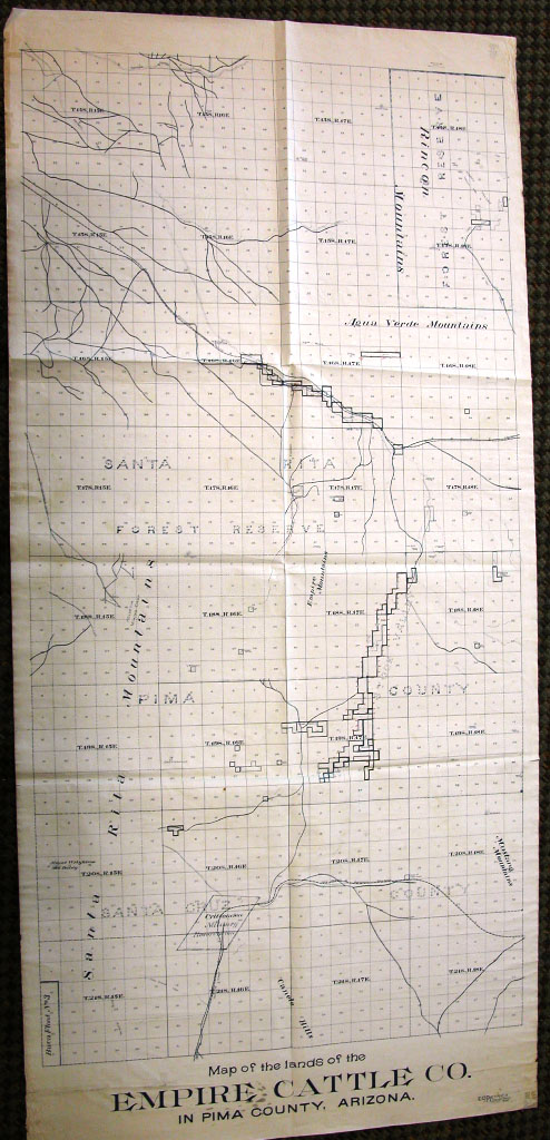
1905 map of the lands comprising the Empire Cattle Co. in Pima County, Arizona.
Call Number
G4333 .P4 1905 D5 Special Collections
Format
jpg
Title
Map of the lands of the Empire Cattle Co. in Pima County, Arizona 1905
Abstract
Following the 1803 Louisiana Purchase, the Federal government started surveying the West with the intention of selling as much land as possible to the public. The system used divided land into thirty-six single-square-mile sections. Each section equaled 640 acres or one square mile. Thirty-six squares made up one township. This system is still in use today. This 1905 map offers an excellent example of the acquisition of land under this system by the Empire Cattle Company.
Created
1905
Copyrighted
1905
Download
Keywords

